
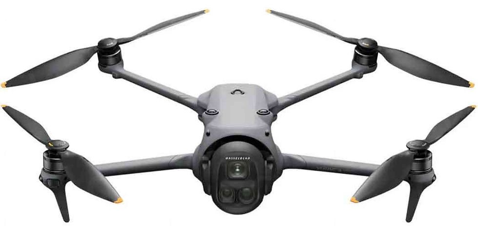
Mavic 3 Enterprise E and T (Thermal)
- michael marshall
- Jul 31, 2025
- 2 min read


Why Marshalls Drone Services Uses the DJI Mavic 3 Enterprise Series with RTK
At Marshalls Drone Services Ltd, precision, efficiency, and reliability are at the core of everything we do. That’s why we’ve invested in the DJI Mavic 3 Enterprise Series—specifically the Mavic 3E and Mavic 3T—paired with the powerful DJI RTK-3 Base Station. This setup allows us to deliver highly accurate aerial surveys, inspections, and thermal imaging across a wide range of sectors.
The Mavic 3E (Enterprise) is equipped with a 20MP wide-angle camera with a mechanical shutter, ideal for detailed photogrammetry and mapping. It drastically reduces motion blur and enables fast data capture, even during large-scale surveying missions. The Mavic 3T (Thermal) adds high-resolution thermal imaging, which is invaluable for roof inspections, solar panel analysis, and emergency response work.
When paired with the RTK-3 Base Station, these drones achieve centimetre-level positioning accuracy—crucial for producing survey-grade maps and 3D models. This eliminates the need for time-consuming ground control points, speeding up workflows and reducing on-site labour. It's a game-changer for clients in construction, utilities, and infrastructure.
As a CAA-authorised operator, we ensure all flights are compliant with UK airspace regulations. The Mavic 3 Enterprise drones come with advanced safety features including omnidirectional obstacle sensing, real-time terrain following, and long endurance—making them reliable even in complex environments.
Whether we’re conducting a precise site survey or diagnosing thermal anomalies in a building, this drone setup gives Marshalls Drone Services the ability to deliver accurate, high-value results efficiently and safely.
By combining high-end drone technology with professional expertise, we help clients make smarter decisions, reduce costs, and gain deeper insight—both from the air and in the data.


Comments